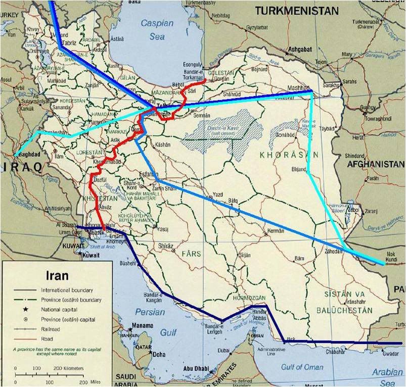
The physical geography of Iran makes building a railway across the country a no-brainer -- you go northwest-to-southeast so you aren't cutting across all the huge mountain ranges. But Reza Shah wanted so badly to screw over the colonial powers that he was willing to do whatever. Check out this map -- Russia proposed Caucasus-to-Karachi lines that would give access to a warm-water port, and Britain wanted to connect its oil fields in Iraq to its empire in India. Those are all shown in blue. But no, the Shah decided to build an engineering marvel that would cut against the grain of the topography, crossing both the Elborz and Zagros Mountains and requiring 224 tunnels and 4,102 bridges along its 870-mile route. His route is in red.
The Shah did all this because he thought the British and Russians would eventually invade his country if they got the rail lines they wanted. He built the gauge so it wouldn't match with the railways of Russia, Iraq, or India; he used it to connect ports on the Indian Ocean and the Caspian Sea that were unfavorable to both Britain and Russia; he financed it by taxing his own people to death so he wouldn't have to borrow money from colonial powers. He even divided up the contracting of the route so that no foreign country would have undue influence on its construction. The project made Reza Shah look like a hero, even though it was incredibly expensive -- it made Iran suddenly look modern because it was the first country in the region to make such a massive investment in its own infrastructure.

But the Shah gave a little too much work to the Germans, who built the Tehran railway station with swastikas all over the ceiling. When Germany attacked the Soviets in World War II, the Allied Powers used the German influence on the railway as a pretense for invasion. The Allies needed to get supplies to the Soviets as quickly as possible, and it worked out that the standard gauge the Shah had chosen for the railway matched the gauge of American locomotives and rolling stock. So the Americans played a large part in building up the railway's infrastructure, and in the end, the Trans-Iranian Railway was used in the service of the very colonial powers it had been constructed to rebel against.
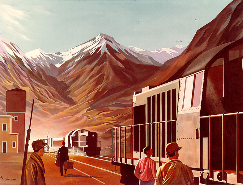
And that's how Richard H. Jansen, an American painter notable for -- well, nothing, besides creating murals for the post offices of Lincolnton, North Carolina and Reedsburg, Wisconsin -- ended up making this great painting of the Trans-Iranian Railway:
Nowadays the railway still functions as the backbone of Iran's extensive rail network. But it still creates problems -- its gauge is still incompatible with those of neighboring countries, and the old British dream of a single rail line that could cross Asia via Iran is still unrealized.
I'm wondering -- has anyone here ever traveled on this railroad?